


Pilot Nick - 10 mn read
In this briefing:
Why 78 knots of typhoon wind makes hundreds of cancellations a matter of arithmetic, and the mental shortcut pilots use to turn any wind into a go or no-go in seconds.
The fuel plan that lets a crew say no: how we carry enough to hold, give up, and still reach an airport far outside the storm when every runway in the region closes at once.
Why the autopilot stays off, why the nose points sideways, and why the hardest landing of the year is firm on purpose. There’s a formula for that.
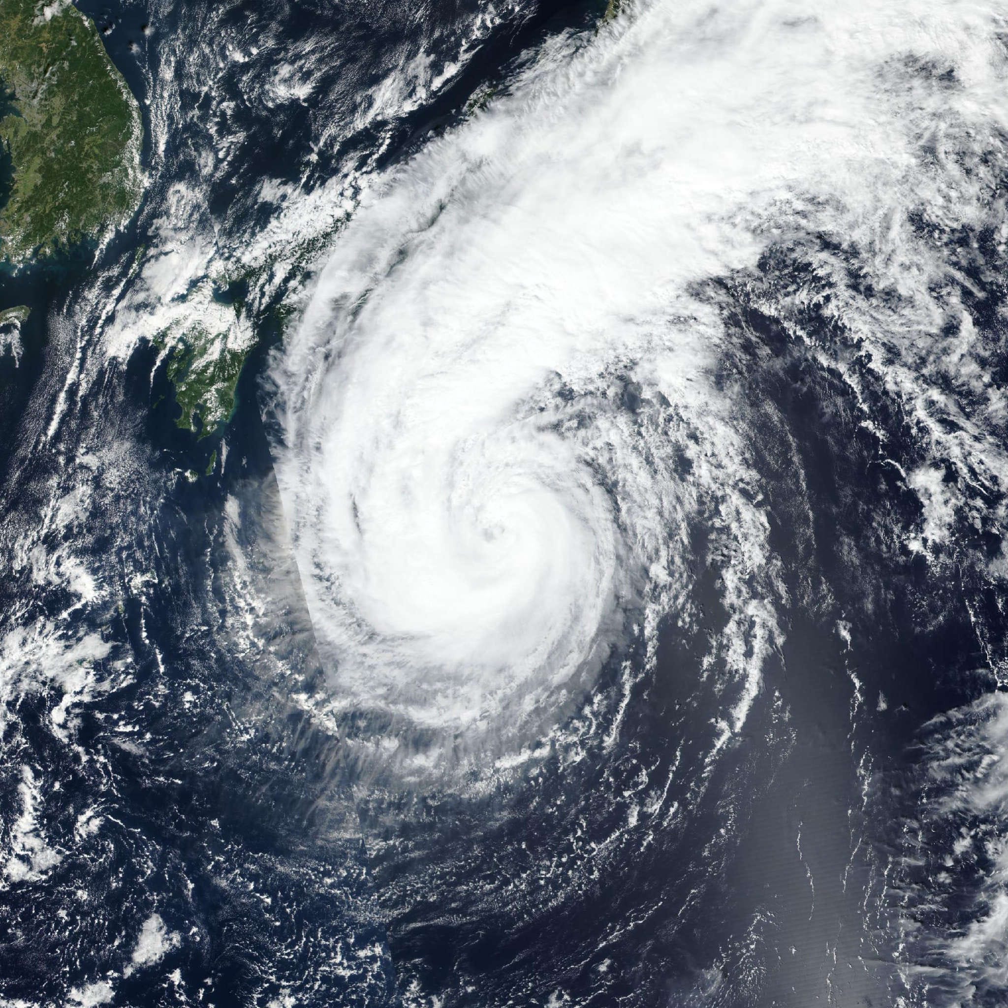
As I write this, it’s Monday night in Tokyo, and Typhoon Dujuan, the 25th storm of the season, is about 130 km off the Chiba coast with winds of 144 km/h.
Japan Airlines has cancelled 135 flights. All Nippon Airways, 140. Count every carrier at Haneda and Narita, and some reports put the total close to 500.
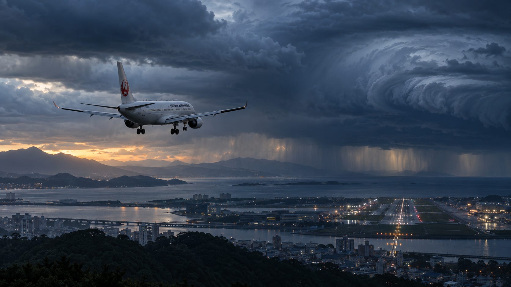
And yet, on the edges of that storm, airliners are still landing. See below the video
Landing in the outer bands of Typhoon Dujuan.
That’s what it looks like from a window seat: grey, wet, loud, and over in thirty seconds.
What you can’t see is the nine hours of work behind it. The fuel that was loaded for this exact approach. The crosswind number the crew checked against a hard limit. The go-around they briefed and didn’t need. The reason that touchdown was firm on purpose.
Most coverage stops at the cancellation count. This post starts there.
So I’m trying something different today. I’m going to take you through a typhoon arrival the way a crew works through it, phase by phase, with the actual numbers, limits and procedures. The briefing passengers never hear.
Watch the video once now. Then watch it again when you’ve finished reading. You’ll see different things the second time.
Two disclaimers before we start.
First, a heads-up: this one is more technical than my usual posts. There are acronyms, formulas and a bit of maths. I explain everything in plain English as we go, so you don’t need to be a pilot to follow it. But if you came for a story, this is more of a cockpit manual. Let me know in the comments if you want more like this.
Second: exact figures vary by aircraft type and by operator. Where I give a number, it’s a representative one. The logic is universal.
Phase 0: Convert the headline ✈️
First thing any pilot does with a storm headline: convert it.
144 km/h is 78 knots. On the Japan Meteorological Agency scale, which uses 10-minute average winds, that makes Dujuan a “strong” typhoon (64 to 84 knots). Above that comes “very strong” (85 to 104) and “violent” (105 and up).
Now compare 78 knots with what an airliner can accept across the runway: typically somewhere in the 30s of knots on a dry runway, less on a wet one.
So nobody lands near the core. Those 275 cancellations aren’t caution. They’re arithmetic.
But a typhoon is hundreds of kilometers wide, and its wind field fades with distance. On the edges, airports stay open with winds that are strong but legal. That’s where everything below applies.
Phase 1: Reading the weather picture
We don’t get our typhoon information from the news. We get it from four products.
The tropical cyclone advisory. Tokyo hosts one of the world’s Tropical Cyclone Advisory Centres. It publishes the storm’s position, movement, central pressure and maximum wind, with forecast positions out to 24 hours and beyond. That track is what dispatch overlays on our arrival time.
The SIGMET. A warning to all aircraft of a hazard area to avoid en route. For a typhoon it defines the cyclone’s position and the radius of the cumulonimbus around it.
The TAF. The airport forecast. On a typhoon day you hunt for two things: the gust figures, and the TEMPO groups, which describe temporary conditions lasting less than an hour at a time. A forecast that is legal in its base conditions but illegal in its TEMPO is a forecast that says “bring holding fuel.”
The METAR. The actual observation, every 30 minutes. An illustrative one (not tonight’s real report) might read:
RJAA 210900Z 09040G60KT 3000 +SHRA BKN008 FEW015CB 24/23 Q0985
Translation: Narita, the 21st at 0900 UTC. Wind from 090 degrees at 40 knots, gusting 60. Visibility 3,000 meters in heavy rain showers. Cloud base 800 feet, with cumulonimbus at 1,500. Temperature 24, dew point 23. Pressure 985 hectopascals, which is very low.
One more piece of storm geometry pilots carry around. In the northern hemisphere, the right-hand side of the storm’s track is the dangerous semicircle. There, the storm’s rotation and its forward speed add together. On the left, they partly cancel. Which side of the track your airport sits on changes the wind by tens of knots.
Phase 2: The crosswind math
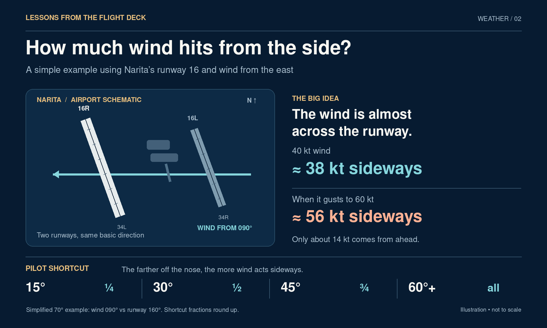
That wind of 090 at 40 gusting 60 means nothing until you compare it to the runway.
Narita’s runways are 16/34, pointing roughly 160 and 340 degrees. Wind from 090 onto runway 16 is 70 degrees off the nose. Crosswind component is wind speed times the sine of that angle: sin 70° is 0.94.
Crosswind: 38 knots, gusting 56. Headwind component: only 14. That runway is closed to you, whatever the airport’s status says.
In the cockpit we don’t do trigonometry. We use the clock code: 15 degrees off gives a quarter of the wind as crosswind, 30 degrees gives half, 45 degrees gives three quarters, and from 60 degrees on, you take all of it.
Two details matter here.
First, the published figure in the flight manual is a maximum demonstrated crosswind: what test pilots showed during certification, on a dry runway. Operators then set their own hard limits, usually lower on wet or contaminated surfaces, and lower again for less experienced pilots. Whether gusts count against the limit is a company policy decision too.
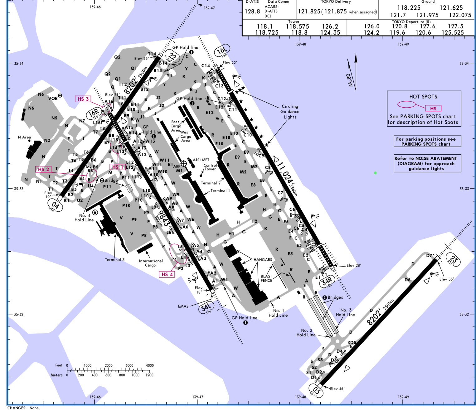
Second, runway layout. Haneda has four runways in two orientations (16/34 and 04/22, 05/23), so controllers can often offer one closer to the wind. Narita’s two runways are parallel, and the third one under construction is parallel as well. When the wind swings across at Narita, there’s no better option on the field.
Phase 3: The fuel ladder
This is the part of typhoon flying that matters most, and it all happens before engine start.
Every airline flight carries fuel in layers:
Taxi fuel, then trip fuel to the destination. Contingency fuel, typically 5% of trip fuel, for the unforeseen. Alternate fuel: a missed approach at destination, then the flight to the alternate. And final reserve: 30 minutes of holding at 1,500 feet above the alternate for a jet. That last layer is sacred. You plan never to touch it.
On top sits extra fuel, at the captain’s discretion. On a typhoon day, that’s where the real decisions live.
Here’s what people miss: a typhoon doesn’t close one airport. It can close every airport in the region at the same time. Then dozens of aircraft all need somewhere else to go at once, and the nearby alternates fill up or close too.
So we plan for exactly that. We carry plenty of fuel to hold over the destination and wait for a gap, and then still fly to an alternate far away from it, well clear of the storm’s footprint, and land there with reserves intact. For Tokyo, that’s thinking Osaka or Nagoya, or further, not the airport next door. Holding fuel and far-alternate fuel aren’t either/or. We take both.
There’s a cost. Extra fuel is extra weight, which means a higher approach speed and a longer landing roll on a wet runway. Occasionally it’s a payload problem too. Fuel is never free, which is why the amount is a decision and not a reflex.
And if it all goes wrong, there’s a precise vocabulary. “Minimum fuel“ tells ATC we’re committed to one airport and any further delay will eat into final reserve. It’s information, not an emergency. “Mayday, mayday, mayday, fuel“ means we now expect to land with less than final reserve. That one gets you priority, and a report to write.
I learned why this ladder matters on December 26, 1999.
I was a first officer when storm Lothar crossed France, Switzerland and Germany in a few hours, with gusts well over 150 km/h. We were flying along its edges. The approaches were the roughest I had ever flown. The airspeed needle was breathing like something alive. Behind the cockpit door, passengers were being sick.
Into Munich, the numbers wouldn’t hold still. We went around, and we diverted to Amsterdam.
It was miserable for everyone in the back. But the decision itself was undramatic, because the fuel to make it was already in the tanks. That’s what the ladder buys you: the ability to say no.
That’s the planning. Everything so far happens before the top of descent.
Below the line is the flying: how approach speed is actually calculated in gusts, why we hand-fly when the autopilot could land the aircraft by itself, what the windshear systems do and the exact escape maneuver, the runway condition codes, the aquaplaning formula, what happens after touchdown, and how an airport and its aircraft ride out the storm on the ground. Plus a one-page Typhoon Numbers Card.
